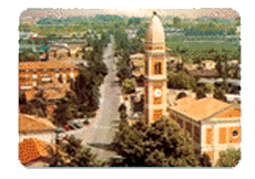
 The town of Rio Saliceto is situated in the northwestern plains of the Province of Reggio Emilia, and is characterised mainly by 18th and 19th-century artistic styles. Rio Saliceto was first mentioned in written records from the 10th century A.D.
Postal code: 42010
Open-air market on Fridays
Village Fair held on the second Sunday in May
Feast of San Giorgio the Martyr, Patron Saint of Rio Saliceto, April 23
Outlying village: San Lodovico
Inhabitants:
5685 update Dicember, 31 2007 |
How to get there:
Distance from Reggio Emilia: 23 km. Take National Road SS 468 from Reggio Emilia travelling in the direction of Correggio, and turn onto Provincial Road SP 5 in the direction of Campagnola Emilia and Novellara.
Public Service Transport |
Tourist information:
Town Hall 0522 647811 Fax 0522 647822 |
Known for centuries as Villa di Correggio, it was not until 1860 that Rio Saliceto achieved an autonomous town government. The town was initially called Rio after the canal (known today as the Tresinaro) that runs along the border between the territory of Rio Saliceto and the territory of Carpi. Rio was later called San Giorgio in Rio, and in 1864 the name officially became Rio Saliceto, in reference to the willow trees that grow in the area.
The land in the area was partially reclaimed by the Romans, and several archeological finds that have come to light here have been traced back to the time of the Roman Empire. These include a tomb with a marble lion that is held today in the courtyard of Palazzo dei Principi in Correggio, a brick with a special groove on the surface to make it easier to grip, which was found in Via Ca' de' Frati during excavation for a well in 1969 and which is now held in the public library, and parts of a floor mosaic that was found in 1912 in the same area as the brick.
In a document signed in 772 A.D. by Lombardic King Desiderius, the area including the spot where the current town lies is described as being made up of "earth, blind alleys, and meadows", with very few inhabitants. In 907 A.D., part of the same territory belonged to the Church of Reggio, later becoming the property of Boniface of Canossa, father of Matilda, Countess of Canossa, who gave the land back to the Church. In 1093, the name of the town appeared for the first time in a papal bull signed by Antipope Gilbert. Between the 12th and 13th centuries, Rio was registered in the "Book of Hearth Fires" from the district of Reggio as having 20 families of independent farmers and 7 sharecroppers. Rio was subject to the Da Correggio family, and the mint belonging to their principality was located in Villa Caprì, a locality in the territory of Rio. In 1635 the territory came under the rule of the Duke of Modena and Reggio, Francesco d'Este I.
In 1859, a plebiscite sanctioned an independent government for the town of Rio Saliceto, taking effect on 1 January 1860. On 18 April 1881, following the example set by Reggio Emilia and Novellara, the Workers' Mutual Aid Society was set up, with the objective of lending assistance to workers experiencing hardship. A building was erected in 1913 in Piazza Carducci, next to the school buildings, to house the society. With the same objective, Alfredo Ansaloni founded the analogous Military Brotherhood Society while on leave in 1899. The first cooperative company was set up on 23 August 1901. Called "L'Enologica", it combined the sale and production of local wines with the goal of raising the importance of the area's special types of wines and increasing sales.
The rapid demographic and economic growth of Rio Saliceto in the past few decades has allowed the town to improve its municipal, social and educational services, in which various sports, cultural, and volunteer groups and associations are actively involved, contributing to complete the picture of a lively, hardworking community.