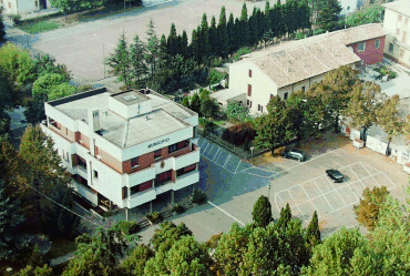
 The territory of Campegine covers an area of 22 sq. km. in the central part of the river Po Valley. The fertile land has many natural springs of water, and is one of the most important archeological sites in the Province of Reggio Emilia.
Postal code: 42040
Feast of San Pietro and San Paolo, Patron Saints of Campegine, 29 June
Feast of San Rocco, 16 August in Caprara
Outlying villages: Caprara, Case Cocconi, Lora, and Razza.
Open-air market held on Tuesdays
Inhabitants:
5.151 update Dicember, 31 2009 |
How to get there:
Distance from Reggio Emilia: 15 km.
By car: with motor-way A1 , exit "Terre di Canossa-Campegine", or on ordinary road Via Emilia (National Road SS 9) , turn north at Calerno.
By train/bus: nearest station: Reggio Emilia. Direct bus to Campegine from the bus station in Reggio Emilia, piazzale europa.
|
Tourist information:
Town Hall 0522 676521 Fax 0522 676314 |
The name of this town derived from the Latin root "campus" (meaning field or countryside). Different versions of the name existed, such as Campicinum, Campigene, and Campeginem, which is the version found in a charter signed by Charlemagne in 781 A.D., defining the border between Parma and Reggio Emilia.
Campegine has always been rich in natural springs of water. Due to this feature, numerous traces of prehistoric settlements have been found in the area, as well as the underground layout for an ancient Roman aqueduct, which is located in the western part of the territory. The aqueduct carried drinking water from the Castellina fountains to Brixellum (current-day Brescello), an important Roman garrison on the Po River. Agriculture provided a living for the inhabitants of the area in the most remote past, and developed with the progressive reclamation of these wetlands by the Roman legions and Benedictine monks, the imposing operations carried out by Marquis Corneglio Bentivoglio during the latter part of the 16th century, and the Este government of Ferrara, which ruled the territory for almost four centuries. Campegine became an independent town in 1860, and paid a high price with the blood of its citizens during Italy's most recent history, particularly during the uprisings against a tax levied on the sale of ground meat in 1869, and in the rebellion against the Nazis and Fascists.
In the territory south of the town of Campegine, near the A1 motor-way, stands the Valle Re farm court, which dates back to the 15th century. In the 18th century this belonged to the famous family of Filippo Re, a famous agronomist. The compound is now in poor condition. The Emilia-Romagna Region set up the Corte Valle Re nature reserve in the surrounding area in 1992.
The Gualtirolo Court is located along the same road as Valle Re, proceeding north near the Cava Canal. This is a very old fortified village that was turned into a prosperous farm by Benedictine monks from the Monastery of San Prospero of Reggio Emilia, who owned it from 1080 to 1782. The farm was well-known for raising cattle and producing Parmigiano-Reggiano cheese for eight long centuries.
The tomb of the seven Cervi Brothers is located in the Campegine Cemetery. The brothers were shot by Fascists on 28 December 1943. Their father, Alcide, and mother, Genoveffa Cocconi, are buried in the same funeral chapel.